
Gracias por apoyar a este sitio ❤️
Haz una donación
Haz una donación
Mapa topográfico Kanpur
Haga clic en el mapa para ver la altitud.
Gracias por apoyar a este sitio ❤️
Haz una donación
Haz una donación
Kanpur
Situated in the flat Indo-Gangetic Plains, Kanpur has an average elevation of 318 metres (1,043 ft) above sea level. The Ganga flows by the city and several ghats are located on its banks, notably the Sati Chaura Ghat and Sarsaiya Ghat. The Brahmavart Ghat located at Bithoor (25 km northwards) is another ghat of religious importance.
Gracias por apoyar a este sitio ❤️
Haz una donación
Haz una donación
Acerca de este mapa
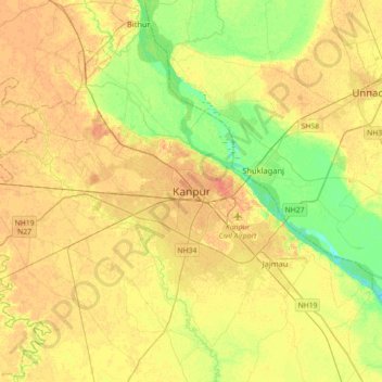
Nombre: Mapa topográfico Kanpur, altitud, relieve.
Lugar: Kanpur, Kanpur Nagar, Uttar Pradesh, 208012, India (26.30091 80.16176 26.62091 80.48176)
Altitud media: 124 m
Altitud mínima: 105 m
Altitud máxima: 137 m
Gracias por apoyar a este sitio ❤️
Haz una donación
Haz una donación