
Mapa topográfico Placerville
Mapa interactivo
Haga clic en el mapa para ver la altitud.
Placerville
The region east of Placerville, popularly known as Apple Hill and Pleasant Valley, is becoming a center for wine production. The wine region is officially designated as the El Dorado AVA. The largest wineries in the area are Boeger, Lava Cap and Madrona, but most of the 30 plus wineries surrounding Placerville are family owned and smaller in wine grape and wine production. The region is "renown for making vibrantly flavorful, distinctly delicious wines, grown in the dramatic elevations of the Sierra Nevada." The area is increasingly a center for sophisticated production of Rhone style wines, noted by El Dorado County having a local chapter of the Rhone Rangers winemaker association.
Acerca de este mapa
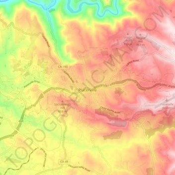
Nombre: Mapa topográfico Placerville, altitud, relieve.
Lugar: Placerville, El Dorado County, California, United States (38.71286 -120.85147 38.74854 -120.75050)
Altitud media: 587 m
Altitud mínima: 265 m
Altitud máxima: 807 m