
Gracias por apoyar a este sitio ❤️
Haz una donación
Haz una donación
Mapa topográfico Schipkau
Haga clic en el mapa para ver la altitud.
Gracias por apoyar a este sitio ❤️
Haz una donación
Haz una donación
Schipkau
On September 19th, 2024 construction work on GICON High-Altitude Wind Turbine in Klettwitz wind park, which belongs to Schipkau, started. It will have a nacelle height of 300 metres and a rotor diametre of 126 metres. When completed, it will not only be the tallest wind turbine in the world, but also the second-tallest man-made object in Germany and one of the tallest structures in the European Union [1].
Gracias por apoyar a este sitio ❤️
Haz una donación
Haz una donación
Acerca de este mapa
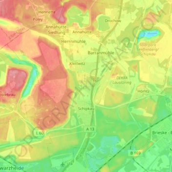
Nombre: Mapa topográfico Schipkau, altitud, relieve.
Altitud media: 123 m
Altitud mínima: 79 m
Altitud máxima: 171 m
Gracias por apoyar a este sitio ❤️
Haz una donación
Haz una donación
Otros mapas topográficos
Haga clic en un mapa para ver su topografía, su altitud y su relieve.