
Gracias por apoyar a este sitio ❤️
Haz una donación
Haz una donación
Mapa topográfico Pasighat
Haga clic en el mapa para ver la altitud.
Gracias por apoyar a este sitio ❤️
Haz una donación
Haz una donación
Pasighat
Pasighat is located at 28°04′N 95°20′E / 28.07°N 95.33°E / 28.07; 95.33. It has an average elevation of 153 metres or 502 feet. Pasighat has a typical lowland Northeast India humid subtropical climate (Köppen Cwa) a little too cool to qualify as a tropical monsoon climate (Am).
Gracias por apoyar a este sitio ❤️
Haz una donación
Haz una donación
Acerca de este mapa
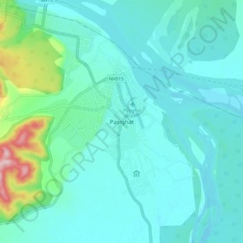
Nombre: Mapa topográfico Pasighat, altitud, relieve.
Lugar: Pasighat, Pasighat HQ, East Siang, Arunachal Pradesh, India (28.01897 95.29249 28.09897 95.37249)
Altitud media: 179 m
Altitud mínima: 139 m
Altitud máxima: 393 m
Gracias por apoyar a este sitio ❤️
Haz una donación
Haz una donación