
Haz una donación
Mapa topográfico Delta
Haga clic en el mapa para ver la altitud.
Haz una donación
Delta
Delta experiences a cold semi-arid climate (Köppen BSk) with hot summers and cold winters. Because of Delta's altitude and aridity, temperatures drop quickly after sunset, especially in the summer. Winters are cold. Daytime highs in the winter are usually above freezing, but nighttime lows drop well below freezing, occasionally falling below 0 °F or −17.8 °C. Delta's climate is similar to that of Salt Lake City, but much more arid.
Haz una donación
Acerca de este mapa
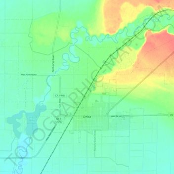
Nombre: Mapa topográfico Delta, altitud, relieve.
Lugar: Delta, Millard County, Utah, United States (39.33856 -112.61453 39.39694 -112.49604)
Altitud media: 1.417 m
Altitud mínima: 1.401 m
Altitud máxima: 1.453 m
Haz una donación
Otros mapas topográficos
Haga clic en un mapa para ver su topografía, su altitud y su relieve.