
Haz una donación
Mapa topográfico Trapani
Haga clic en el mapa para ver la altitud.
Haz una donación
Trapani
Much of the built-up peninsula is very low-lying, with the city’s average elevation around 3 m above sea level. To the north a strip of sandy beach runs below the Mura di Tramontana at the edge of the historic centre, while to the south the urban area gives way to the low-lying salt-pans and wetlands of the Trapani–Paceco reserve. This combination of low relief, beaches and saline basins has encouraged modern expansion mainly eastwards along the Via G.B. Fardella axis on the landward side of the peninsula.
Haz una donación
Acerca de este mapa
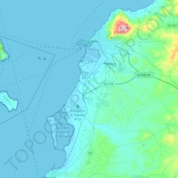
Nombre: Mapa topográfico Trapani, altitud, relieve.
Lugar: Trapani, Sicily, 91100, Italy (37.83681 12.43849 38.04349 12.80085)
Altitud media: 56 m
Altitud mínima: -2 m
Altitud máxima: 756 m
Haz una donación
Otros mapas topográficos
Haga clic en un mapa para ver su topografía, su altitud y su relieve.
Haz una donación
Haz una donación