
Gracias por apoyar a este sitio ❤️
Haz una donación
Haz una donación
Mapa topográfico Faßmannsreuth
Haga clic en el mapa para ver la altitud.
Gracias por apoyar a este sitio ❤️
Haz una donación
Haz una donación
Acerca de este mapa
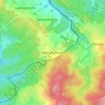
Nombre: Mapa topográfico Faßmannsreuth, altitud, relieve.
Lugar: Faßmannsreuth, Rehau, Landkreis Hof, Bayern, Deutschland (50.25177 12.10446 50.29177 12.14446)
Altitud media: 615 m
Altitud mínima: 565 m
Altitud máxima: 691 m
Gracias por apoyar a este sitio ❤️
Haz una donación
Haz una donación