
Mapa topográfico Blackfoot
Mapa interactivo
Haga clic en el mapa para ver la altitud.
Acerca de este mapa
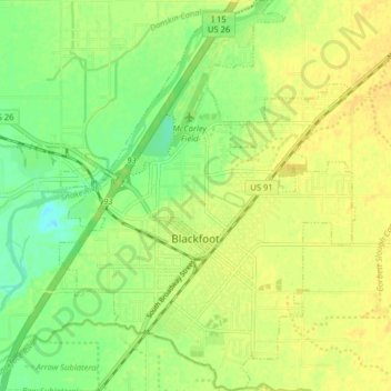
Nombre: Mapa topográfico Blackfoot, altitud, relieve.
Lugar: Blackfoot, Bingham County, Idaho, 83221, United States (43.16747 -112.37616 43.22556 -112.31578)
Altitud media: 1.371 m
Altitud mínima: 1.357 m
Altitud máxima: 1.380 m
Otros mapas topográficos
Haga clic en un mapa para ver su topografía, su altitud y su relieve.
Aberdeen
United States > Idaho > Bingham County
Aberdeen, Bingham County, Idaho, 83210, United States
Altitud media: 1.341 m
Atomic City
United States > Idaho > Bingham County
Atomic City, Bingham County, Idaho, 83215, United States
Altitud media: 1.533 m
Fort Hall
United States > Idaho > Bingham County
Fort Hall, Bingham County, Idaho, 83203, United States
Altitud media: 1.356 m