
Mapa topográfico Marinduque
Haga clic en el mapa para ver la altitud.
Acerca de este mapa
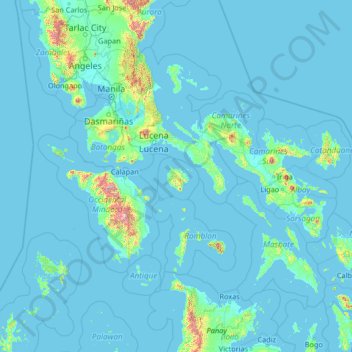
Nombre: Mapa topográfico Marinduque, altitud, relieve.
Lugar: Marinduque, Mimaropa, Philippines (10.81667 119.35000 16.01667 124.55000)
Altitud media: 54 m
Altitud mínima: -2 m
Altitud máxima: 2.398 m
Otros mapas topográficos
Haga clic en un mapa para ver su topografía, su altitud y su relieve.
Pangil
The municipality is strategically situated at the southern tip of Sierra Madre mountain range (six barangays) and along the eastern margin of Jalajala Peninsula and just west of the northwestern shore of the easternmost major embayment of Laguna de Bay (two barangays). Its narrow strip of territory traverses…
Altitud media: 165 m
Baguio
In 1903, Filipinos, Japanese and Chinese workers were hired to build Kennon Road, the first road directly connecting Baguio with the lowlands of La Union and Pangasinan. Before this, the only road to Benguet was Naguilian Road, and it was largely a horse trail at higher elevations. Camp John Hay was…
Altitud media: 1.371 m
Metro Manila
The Coastal Margin or Lowland is a flat and low plain that faces Manila Bay. Located here is Manila, Navotas, parts of Malabon, and the western part and reclaimed areas of Pasay and Parañaque, where the ground elevation ranges from zero meters on Manila Bay to five meters at the west side of the cities of…
Altitud media: 43 m
Bukidnon
Situated within Bukidnon is Mount Dulang-dulang, the 2nd highest mountain in the country, with an elevation of 2,938 metres (9,639 ft) located in the Kitanglad Mountain Range. Mount Kitanglad (2,899 m), Mount Kalatungan (2,860 m), Mount Maagnaw (2,742 m), Mount Lumuluyaw (2,612 m), and Mount Tuminungan (2,400…
Altitud media: 686 m
Tagaytay
It is one of the country's most popular destinations for domestic tourism because of its scenery and cooler climate provided by its altitude. Tagaytay overlooks Taal Lake in Batangas and provides views of Taal Volcano Island in the middle of the lake through various vantage points situated in the city.
Altitud media: 348 m
Zamboanga City
The overall topography of the city could be described as rolling to very steep. There are some flat lands, mostly narrow strips along the east coast. The urban center is mostly flat with a gentle slope to the interior, ranging from 0% to 3%. A portion, about 38,000 hectares, has slopes ranging from 18% to 30%.…
Altitud media: 78 m
Negros Occidental
Negros Occidental has a tropical climate due to the fact that it is situated close to the equator, being located at least nine degrees north of it. The northern section of the province has a tropical rainforest (Köppen: Af) climate, whereas the southern portion has a tropical monsoon (Köppen: Am) climate.…
Altitud media: 126 m
Isabela
The province is divided into three physiographic areas. The eastern area, straddled by the Sierra Madre mountain range, is rugged and thickly forested. A substantial portion is uncharted. These unexplored hinterlands are home to a rich variety of flora and fauna, and some are under government reservations. It…
Altitud media: 227 m
Mindanao
In the eastern portion of the island, from Bilas Point in Surigao del Norte to Cape San Agustin in Davao Oriental, is a range of complex mountains known in their northern portion as the Diwata Mountains. This range is low and rolling in its central portion. A proposed road connecting Bislig on the east coast…
Altitud media: 54 m
Palawan
Palawan's almost 2,000 kilometers (1,200 mi) of irregular coastline is lined with rocky coves and sugar-white sandy beaches. It also harbors a vast stretch of virgin forests that carpet its chain of mountain ranges. The mountain heights average 1,100 meters (3,500 ft) in altitude, with the highest peak rising…
Altitud media: 44 m
Antique
Mount Madja-as is located in Culasi, is the highest peak on the island of Panay. This 2,117-metre-high (6,946 ft) mountain is a dormant volcano with lakes and 14 waterfalls. It is said to be the legendary home of Bulalakaw, the supreme god of the ancients, and beckons as a challenge for hikers and trekkers.…
Altitud media: 53 m
Laguna
Laguna is home to 24 mountains, most of which are inactive volcanoes. The highest peak in Laguna is Mt. Banahaw, with an elevation of 2,170 m (7,120 ft). Banahaw, unlike most other volcanoes in Laguna, is an active complex stratovolcano, which last erupted in 1843. Banahaw is located in the boundary of Laguna…
Altitud media: 183 m
La Trinidad
The terrain is generally mountainous with springs, rivers and creeks. The town has a valley which encompasses several barangays. The valley floor elevation is at 1,300 metres (4,300 ft) above sea level. Elevation ranges from 500 to 1,700 metres (1,600 to 5,600 ft) above sea level.
Altitud media: 1.123 m
Batangas
Batangas is a combination of plains and mountains, including one of the world's smallest volcanoes, Mt. Taal, with an elevation of 600 metres (2,000 ft), located in the middle of the Taal Lake. Other important peaks are Mount Macolod with an elevation of 830 metres (2,720 ft), Mt. Banoy with 960 metres (3,150…
Altitud media: 126 m
Cagayan de Oro
Cagayan de Oro, located along the north-central coast of Mindanao, Philippines, encompasses a diverse topography that significantly influences its terrain. The city spans approximately 488.86 square kilometers (188.75 square miles), featuring a 25-kilometer (16 miles) coastline along Macajalar Bay. The…
Altitud media: 224 m
Sibuyan Island
Sibuyan is a crescent-shaped island, the second largest in an archipelago comprising Romblon Province, Philippines. Located in the namesake Sibuyan Sea, it has an area of 445 square kilometres (172 sq mi) and has a total population of 62,815, as of the 2020 census. The island has two prominent peaks, the…
Altitud media: 182 m
Agno River
The headwaters of Agno River are at the slopes of Mount Data in the Cordillera Mountains at an elevation of 2,090 metres (6,860 ft), where it drains Cretaceous to Paleocene igneous basement rocks, and marine siliciclastic and carbonate rocks. Of its total length, about 90 kilometres (56 mi) runs through…
Altitud media: 521 m
Balut Island
Philippines > Davao Occidental > Sarangani
Balut Island, the westernmost of the Sarangani Islands, is the larger, higher, and better cultivated than Sarangani Island. In the center of the island is Balut Volcano, which is fumarolic on occasion. Balut Island rises to about 1,800 metres (5,900 ft) from the seabed with the highest elevation at 862 metres…
Altitud media: 87 m
Marikina River
The river's depth ranges from 3 to 21 metres (9.8 to 68.9 ft) and spans from 70 to 120 metres (230 to 390 ft). It has a total area of nearly 75.2 hectares (0.752 km2) and is 27 kilometres (17 mi) long. The riverbank has an elevation of 8 meters above sea level at the boundary of San Mateo and Marikina. This…
Altitud media: 66 m
Quezon City
In order to make Quezon's dream a reality and to mobilize funds for the land purchase, the People's Homesite Corporation (PHC) was created on October 14, 1938, as a subsidiary of NDC, with an initial capital of ₱2 million. Roces was the chairman of the Board of PHC, and they immediately acquired the vast…
Altitud media: 39 m
Camiguin
Camiguin Island is a pearl-shaped island with an area of approximately 238 km2 (92 sq mi). The island measures about 23 kilometres (14 mi) at its longest and 14.5 kilometres (9.0 mi) at its widest breadth. The island is mountainous with the highest elevation reaching over 5,000 ft (1,500 m). It is encircled by…
Altitud media: 35 m
Ilocos Sur
Ilocos Sur occupies the central section of the Ilocos Region in northern Luzon. It is bordered by Ilocos Norte to the north, Abra to the northeast, Mountain Province to the east, Benguet to the southeast, La Union to the south, and the South China Sea to the west. Its area of 2,596.00 square kilometres…
Altitud media: 468 m
Bataan
Bataan is divided by two mountain groups of volcanic origins. The northern side is composed of the Mount Natib (elevation 1,253 metres (4,111 ft)), Mount Sta. Rosa and Mount Silangan. The southern group is composed of Mount Mariveles, Mount Samat, and Mount Cuyapo. A narrow pass separates these two mountain…
Altitud media: 70 m
Sorsogon
The province has an irregular topography. Except for landlocked Irosin, all the towns lie along the coast. They are all connected by concrete and asphalt roads. Mountain's sprawl over the northeast, southeast and west portions. Mount Bulusan, the tallest peak, rises 1,560 metres (5,120 ft) above sea level.
Altitud media: 51 m
Mindanao
In the eastern portion of the island, from Bilas Point in Surigao del Norte to Cape San Agustin in Davao Oriental, is a range of complex mountains, called the Eastern Pacific Cordillera, known in their northern portion as the Diwata Mountains. This range is low and rolling in its central portion. A proposed…
Altitud media: 149 m
Tarlac
Like the rest of Central Luzon, the province has three distinct seasons: summer from March to June, monsoon rain from July to early October, and monsoon winter from late October to February. Summer months, especially during May bring frequent, sometimes severe, thunderstorms with high winds, thunder, and hail.…
Altitud media: 217 m
Angeles
Sapangbato is the largest barangay in Angeles in terms of territory, with a total land area of 104,694 sq. meters and a population of 11,262. Located northwest of Angeles near Clark Freeport Zone, it is identified as the barangay in Angeles with the highest elevation of 750 feet above sea level. It is home to…
Altitud media: 98 m
Biliran
The main volcanic island of Biliran features mountainous interiors with very narrow coastal areas. Only the municipalities of Naval and Caibiran have wide plains extending about 7 km (4.3 mi) from the coast suitable for agriculture. Mount Suiro, an inactive volcano, is the highest point on Biliran Island with…
Altitud media: 54 m
Second Thomas Shoal
On July 12, 2016, the UNCLOS tribunal at the Permanent Court of Arbitration concluded that Second Thomas Shoal is, or in its natural condition was, exposed at low tide and submerged at high tide and, accordingly, has low-tide elevations that do not generate an entitlement to a territorial sea, exclusive…
Altitud media: 0 m
Southern Leyte
Along with other mountain forms in the province, Mount Nacolod in Hinunangan town has the highest peak with an elevation of 948 metres (3,110 ft) above sea level. Young volcanic rocks are discovered in the terrain areas, which cover the top of the southern mountain ranges of Mount Cabalian in the Pacific Area…
Altitud media: 66 m
Aklan
Mount Nausang, is formerly the highest peak in Aklan, standing at 5,190 ft (1,580 m), the discovery of Mount Timbaban is much higher, with an elevation of 5,830.1 ft (1,777.0 m) above sea level, Mount Timbaban is not considered as independent mountain, it is still part of Mount Madja-as sub-summit with only…
Altitud media: 96 m
Siquijor
The island lies about 19 kilometres (12 mi) east of the nearest point on southern Negros, 25 kilometres (16 mi) southeast of Cebu, 30 kilometres (19 mi) southwest of Bohol, and 45 kilometres (28 mi) north of Zamboanga del Norte in Mindanao. It is predominantly hilly and in many places the hills reach the sea,…
Altitud media: 17 m
Ilocos Region
The southern parts of the region were severely hit by the 1990 Luzon earthquake. Five municipalities in La Union were affected: Agoo, Aringay, Caba, Santo Tomas, and Tubao with a combined population of 132,208. Many buildings, including the Agoo Municipal hall, the Museo de Iloko, the parish church of Aringay,…
Altitud media: 219 m
Benguet
The province suffers from crop damage resulting from seasonal frost during the cold months of December to March, especially in high-altitude towns such as Atok, Buguias, Mankayan and Kibungan. In February 2007, Benguet suffered crop damage due to temperatures reaching as low as 7 °C (45 °F).
Altitud media: 908 m
Basilan
Basilan National Park is at the eastern portion of the remaining public forest between the city of Isabela and the municipalities of Lamitan, Tipo-Tipo and Sumisip. The park has an elevation of 971 metres (3,186 ft) above sea level, and the tallest peak, Puno Mahaji or Basilan Peak, dominates the park's…
Altitud media: 32 m
Dinagat Islands
Dinagat Islands is a young island-province at the northern tip of Mindanao. Many describe Dinagat Islands as a hidden gem of the Caraga Region XIII. The Islands are enriched with great bio-diversity, abundant natural wonders and rich resources. Dinagat Islands has a multitude of fascinating white sandy beaches…
Altitud media: 24 m