
Mapa topográfico Harpers Ferry
Mapa interactivo
Haga clic en el mapa para ver la altitud.
Harpers Ferry
The town was "easy to seize, and hard to hold", because of its topography: surrounded on three sides by high ground – Bolivar Heights to the west, Loudoun Heights to the south, and Maryland Heights to the east – and surrounded by the Potomac and Shenandoah Rivers, anyone who controlled the heights controlled the city.
Acerca de este mapa
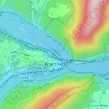
Nombre: Mapa topográfico Harpers Ferry, altitud, relieve.
Altitud media: 174 m
Altitud mínima: 71 m
Altitud máxima: 421 m