
Gracias por apoyar a este sitio ❤️
Haz una donación
Haz una donación
Mapa topográfico Monticello
Haga clic en el mapa para ver la altitud.
Gracias por apoyar a este sitio ❤️
Haz una donación
Haz una donación
Monticello
According to the United States Census Bureau, the city has a total area of 8.94 square miles (23.15 km2), all land. The city's latitude is 45.305 degrees North and its longitude is 93.793 degrees West. Its elevation is 922 feet. Monticello is in the Central time zone.
Gracias por apoyar a este sitio ❤️
Haz una donación
Haz una donación
Acerca de este mapa
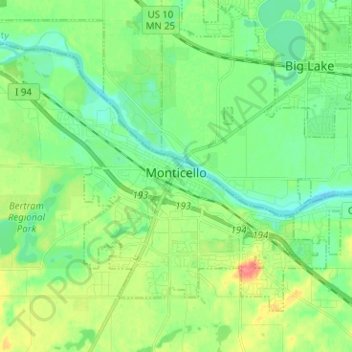
Nombre: Mapa topográfico Monticello, altitud, relieve.
Lugar: Monticello, Wright County, Minnesota, United States (45.27053 -93.86106 45.33840 -93.73503)
Altitud media: 289 m
Altitud mínima: 270 m
Altitud máxima: 327 m
Gracias por apoyar a este sitio ❤️
Haz una donación
Haz una donación