
Gracias por apoyar a este sitio ❤️
Haz una donación
Haz una donación
Mapa topográfico Hachum
Haga clic en el mapa para ver la altitud.
Gracias por apoyar a este sitio ❤️
Haz una donación
Haz una donación
Acerca de este mapa
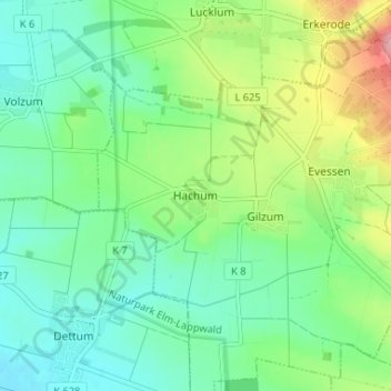
Nombre: Mapa topográfico Hachum, altitud, relieve.
Altitud media: 127 m
Altitud mínima: 87 m
Altitud máxima: 222 m
Gracias por apoyar a este sitio ❤️
Haz una donación
Haz una donación
Otros mapas topográficos
Haga clic en un mapa para ver su topografía, su altitud y su relieve.
Wolfenbüttel
Germany > Lower Saxony > Landkreis Wolfenbüttel
The town center is located at an elevation of 77 ft (23 m) on the Oker river near the confluence with its Altenau tributary, about 13 km (8.1 mi) south of Brunswick and 60 km (37 mi) southeast of the state capital Hannover. Wolfenbüttel is situated about half-way between the Harz mountain range in the south…
Altitud media: 99 m