
Mapa topográfico Jerimoth Hill
Mapa interactivo
Haga clic en el mapa para ver la altitud.
Acerca de este mapa
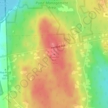
Nombre: Mapa topográfico Jerimoth Hill, altitud, relieve.
Altitud media: 216 m
Altitud mínima: 176 m
Altitud máxima: 247 m
The hill is located on Route 101 in Foster, a half mile from the Connecticut line. To ascend the summit, for which there is a sign, there is a .3-mile (480 m) long trail that has a mere 10-foot (3.0 m) elevation gain. The hill is 812 feet (247 m) high and is located 15 miles (24 km) west of Providence, Rhode Island, and 35 miles (56 km) east of Willimantic, Connecticut.