
Gracias por apoyar a este sitio ❤️
Haz una donación
Haz una donación
Mapa topográfico Falkenstein
Haga clic en el mapa para ver la altitud.
Gracias por apoyar a este sitio ❤️
Haz una donación
Haz una donación
Falkenstein
The linear settlement is located along an old pass road that reaches its highest elevation at 464 m (1522 ft). The village's main street is one of the steepest public roads in Germany with a 25% gradient. Along the road to Winnweiler the Falkensteiner Tal (Falkenstein Valley), known for its rock formations is situated. Most of the district is forested.
Gracias por apoyar a este sitio ❤️
Haz una donación
Haz una donación
Acerca de este mapa
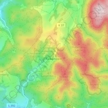
Nombre: Mapa topográfico Falkenstein, altitud, relieve.
Altitud media: 412 m
Altitud mínima: 234 m
Altitud máxima: 649 m
Gracias por apoyar a este sitio ❤️
Haz una donación
Haz una donación