
Gracias por apoyar a este sitio ❤️
Haz una donación
Haz una donación
Mapa topográfico Coachella Valley
Haga clic en el mapa para ver la altitud.
Gracias por apoyar a este sitio ❤️
Haz una donación
Haz una donación
Coachella Valley
The area is surrounded on the southwest by the Santa Rosa Mountains, by the San Jacinto Mountains to the west, the Little San Bernardino Mountains to the east and San Gorgonio Mountain to the north. These mountains peak at around 11,000 feet (3,400 m) and tend to average between 5,000 and 7,000 feet (1,500 and 2,100 m). Elevations on the Valley floor range from 1,600 feet (490 m) above sea level at the north end of the Valley to 250 feet (76 m) below sea level around Mecca.
Gracias por apoyar a este sitio ❤️
Haz una donación
Haz una donación
Acerca de este mapa
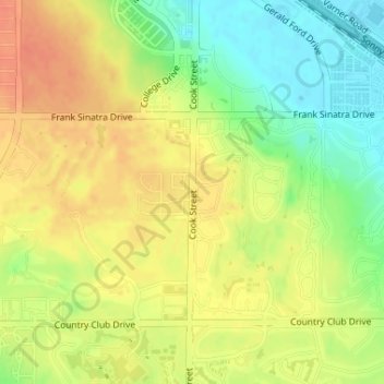
Nombre: Mapa topográfico Coachella Valley, altitud, relieve.
Altitud media: 72 m
Altitud mínima: 47 m
Altitud máxima: 91 m
Gracias por apoyar a este sitio ❤️
Haz una donación
Haz una donación