
Mapa topográfico Elatochori
Mapa interactivo
Haga clic en el mapa para ver la altitud.
Elatochori
Elatochori is known for its ski center, which is located at an altitude of 1,400 to 1,800 meters (4,600 to 5,900 feet) on the southeastern slopes of the Pierian Mountains. At the base of the ski resort and at the location "Papá Choráfi", there is a dining room and a chalet with a total area of 450 sq.m. (4,840 sq.ft.) with a capacity of more than 400 people. It operated for the first time on a trial basis, in 2000, and officially in 2001. It is 8 km (5 miles) from the village and 36 km (22 miles) from the city of Katerini. The Ski Sports and Mountaineering Association operates in the Ski Center.
Acerca de este mapa
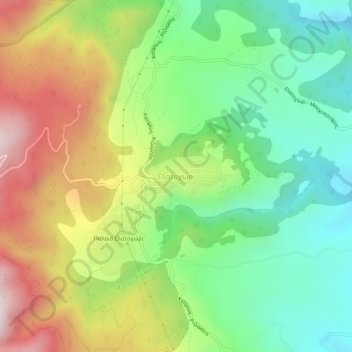
Nombre: Mapa topográfico Elatochori, altitud, relieve.
Altitud media: 722 m
Altitud mínima: 408 m
Altitud máxima: 1.192 m
Otros mapas topográficos
Haga clic en un mapa para ver su topografía, su altitud y su relieve.