
Mapa topográfico Pinyon Pines
Mapa interactivo
Haga clic en el mapa para ver la altitud.
Acerca de este mapa
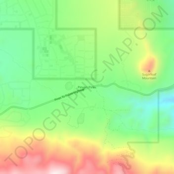
Nombre: Mapa topográfico Pinyon Pines, altitud, relieve.
Altitud media: 1.276 m
Altitud mínima: 1.040 m
Altitud máxima: 1.621 m
It is located in a small valley between the San Jacinto Mountains and Santa Rosa Mountains, north of State Route 74. It takes its name from the Pinyon pine (Pinus monophylla) trees native to the area. Pinyon Pines sits at an elevation of approximately 4000 feet.