Mapa topográfico LaValle Mill Pond
Mapa interactivo
Haga clic en el mapa para ver la altitud.
Acerca de este mapa
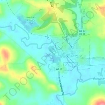
Nombre: Mapa topográfico LaValle Mill Pond, altitud, relieve.
Altitud media: 292 m
Altitud mínima: 268 m
Altitud máxima: 353 m

Haga clic en el mapa para ver la altitud.
Nombre: Mapa topográfico LaValle Mill Pond, altitud, relieve.
Altitud media: 292 m
Altitud mínima: 268 m
Altitud máxima: 353 m