
Mapa topográfico Gerlach
Mapa interactivo
Haga clic en el mapa para ver la altitud.
Acerca de este mapa
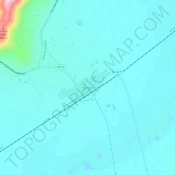
Nombre: Mapa topográfico Gerlach, altitud, relieve.
Lugar: Gerlach, Washoe County, Nevada, 89412, United States (40.63181 -119.37626 40.67181 -119.33626)
Altitud media: 1.208 m
Altitud mínima: 1.171 m
Altitud máxima: 1.510 m
According to the United States Census Bureau, the Gerlach CDP has a total area of 3.1 square miles (8.0 km2), all land. Its elevation is 3,944 ft (1,202 m). Gerlach is approximately 100 miles (160 km) north of Reno, Nevada.