
Gracias por apoyar a este sitio ❤️
Haz una donación
Haz una donación
Mapa topográfico Seehöhe
Haga clic en el mapa para ver la altitud.
Gracias por apoyar a este sitio ❤️
Haz una donación
Haz una donación
Seehöhe
Cierzpięty (deutsch Czierspienten, 1905–1945 Seehöhe) ist ein Dorf in der polnischen Woiwodschaft Ermland-Masuren, das zur Gmina Orzysz (Stadt- und Landgemeinde Arys) im Powiat Piski (Kreis Johannisburg) gehört.
Gracias por apoyar a este sitio ❤️
Haz una donación
Haz una donación
Acerca de este mapa
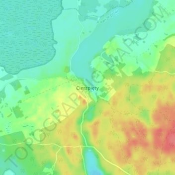
Nombre: Mapa topográfico Seehöhe, altitud, relieve.
Altitud media: 133 m
Altitud mínima: 110 m
Altitud máxima: 173 m
Gracias por apoyar a este sitio ❤️
Haz una donación
Haz una donación