
Gracias por apoyar a este sitio ❤️
Haz una donación
Haz una donación
Mapa topográfico Plattling
Haga clic en el mapa para ver la altitud.
Gracias por apoyar a este sitio ❤️
Haz una donación
Haz una donación
Acerca de este mapa
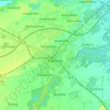
Nombre: Mapa topográfico Plattling, altitud, relieve.
Lugar: Plattling, Landkreis Deggendorf, Bavaria, 94447, Germany (48.75282 12.84104 48.81069 12.96910)
Altitud media: 322 m
Altitud mínima: 311 m
Altitud máxima: 344 m
Gracias por apoyar a este sitio ❤️
Haz una donación
Haz una donación
Otros mapas topográficos
Haga clic en un mapa para ver su topografía, su altitud y su relieve.