
Gracias por apoyar a este sitio ❤️
Haz una donación
Haz una donación
Mapa topográfico Plauen
Haga clic en el mapa para ver la altitud.
Gracias por apoyar a este sitio ❤️
Haz una donación
Haz una donación
Acerca de este mapa
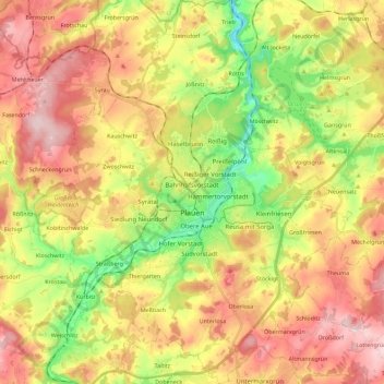
Nombre: Mapa topográfico Plauen, altitud, relieve.
Lugar: Plauen, Vogtlandkreis, Saxony, Germany (50.43067 12.05941 50.57486 12.22946)
Altitud media: 429 m
Altitud mínima: 300 m
Altitud máxima: 553 m
Gracias por apoyar a este sitio ❤️
Haz una donación
Haz una donación
Otros mapas topográficos
Haga clic en un mapa para ver su topografía, su altitud y su relieve.