

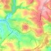
Mapa topográfico Treknow
Haga clic en el mapa para ver la altitud.
Acerca de este mapa

Nombre: Mapa topográfico Treknow, altitud, relieve.
Lugar: Treknow, Tintagel, Cornwall, England, PL34 0EL, United Kingdom (50.62945 -4.77188 50.66945 -4.73188)
Altitud media: 92 m
Altitud mínima: 0 m
Altitud máxima: 258 m
Otros mapas topográficos
Haga clic en un mapa para ver su topografía, su altitud y su relieve.




St. Columb Major
United Kingdom > England > Cornwall
St Columb occupies a plateau at about 300 feet (91 m) elevation. The north part of the town (known as 'Bridge') descends into the Vale of Lanherne, having a minimum elevation of approximately 165 feet (50 m). It was originally a linear settlement built on the main road running north-east to south-west, but…
Altitud media: 110 m


