
Haz una donación
Mapa topográfico Greetsiel
Haga clic en el mapa para ver la altitud.
Haz una donación
Acerca de este mapa
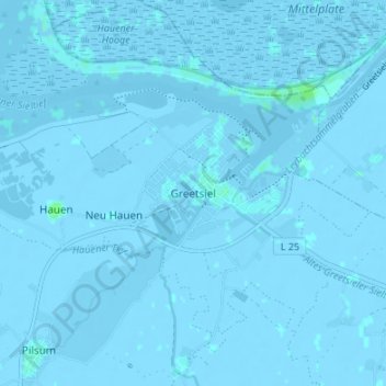
Nombre: Mapa topográfico Greetsiel, altitud, relieve.
Altitud media: -1 m
Altitud mínima: -5 m
Altitud máxima: 6 m
Haz una donación
Otros mapas topográficos
Haga clic en un mapa para ver su topografía, su altitud y su relieve.
Juist
Germany > Lower Saxony > Landkreis Aurich
Juist is accessible by plane or daily ferry. FLN Frisia Luftverkehr operates planes between Norden and Juist. Most motor vehicles are prohibited on the island, with only the fire department, the German Red Cross and doctors allowed to use them. Island tractors require a special license, while most other…
Altitud media: 0 m
Haz una donación
Wiesmoor
Germany > Lower Saxony > Landkreis Aurich
On Friday 13 January 1989, a half year after the Ramstein Airshow Disaster, there was a collision of several military jets at low altitude over the Hinrichsfehn area of Wiesmoor. A tornado of the Royal Air Force collided with a squadron of German Alphas Jets of the Jagdbombergeschwader 43 division. One of the…
Altitud media: 9 m
Haz una donación
Haz una donación